
Upper Shoreham Active Travel Improvements
Scheme Update May 2025
- Upper Shoreham Road – Works are nearing completion. Two way signals will remain in place until Friday 9th May to finish works on the footway and complete some lining.
- Buckingham Road – Works will continue on the installation of the shared cycleway until 16th May. Works will be paused o/s no. 64 until the School summer holidays to ensure minimal disruption.
- Middle Road – Works will commence from 12th May for approx. 2 weeks to upgrade the existing 2 build outs and provide a cycle bypass.
- Upper Shoreham Road by junction Buckingham Close– The ducting and connection works for the speed camera will start 26th May for approximately 3 weeks under temporary traffic signals
- Buckingham Road carriageway resurfacing – Works are now being programmed for 27th-31st October for half term as the road will be closed for safety and to minimise disruption to the school.
Introduction
We are working to improve walking and cycling networks across West Sussex.
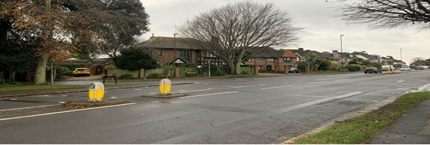
The area where the controlled crossing point is proposed, on Upper Shoreham Road, has been identified as a site where pedestrians and cyclists frequently seek to cross the carriageway. The work we are proposing to carry out will make this a safer and more convenient crossing point.
The Buckingham Road school access proposal has been identified through the school street trial project and seeks to support the safe journey to school and focuses on where pupils cross to access to Buckingham Park Primary School. This directly joins to the Upper Shoreham Road scheme.
Middle Road has also been identified as a site which is heavily trafficked by cyclists. The installation of cycle bypasses through the buildouts will improve safety and connectivity for network users.
These proposals have come from previous engagement and consultation from the local communities and key stakeholders.
Scheme Objectives
The scheme aims to improve safety, continuity and usability for pedestrians and cyclists, by:
- Installation of parallel crossing, on Upper Shoreham Road, just east of its junction with The Drive.
- Installation of associated shared cycle/pedestrian footway route at the junction of The Drive and Upper Shoreham Road, and at the junction of Buckingham Road and Upper Shoreham Road.
- Installation of a segregated cycle lane on the west side of The Triangle at the junction of Upper Shoreham Road and Buckingham Road.
- Improvements to pedestrian crossing points on the approach to Buckingham Park Primary School.
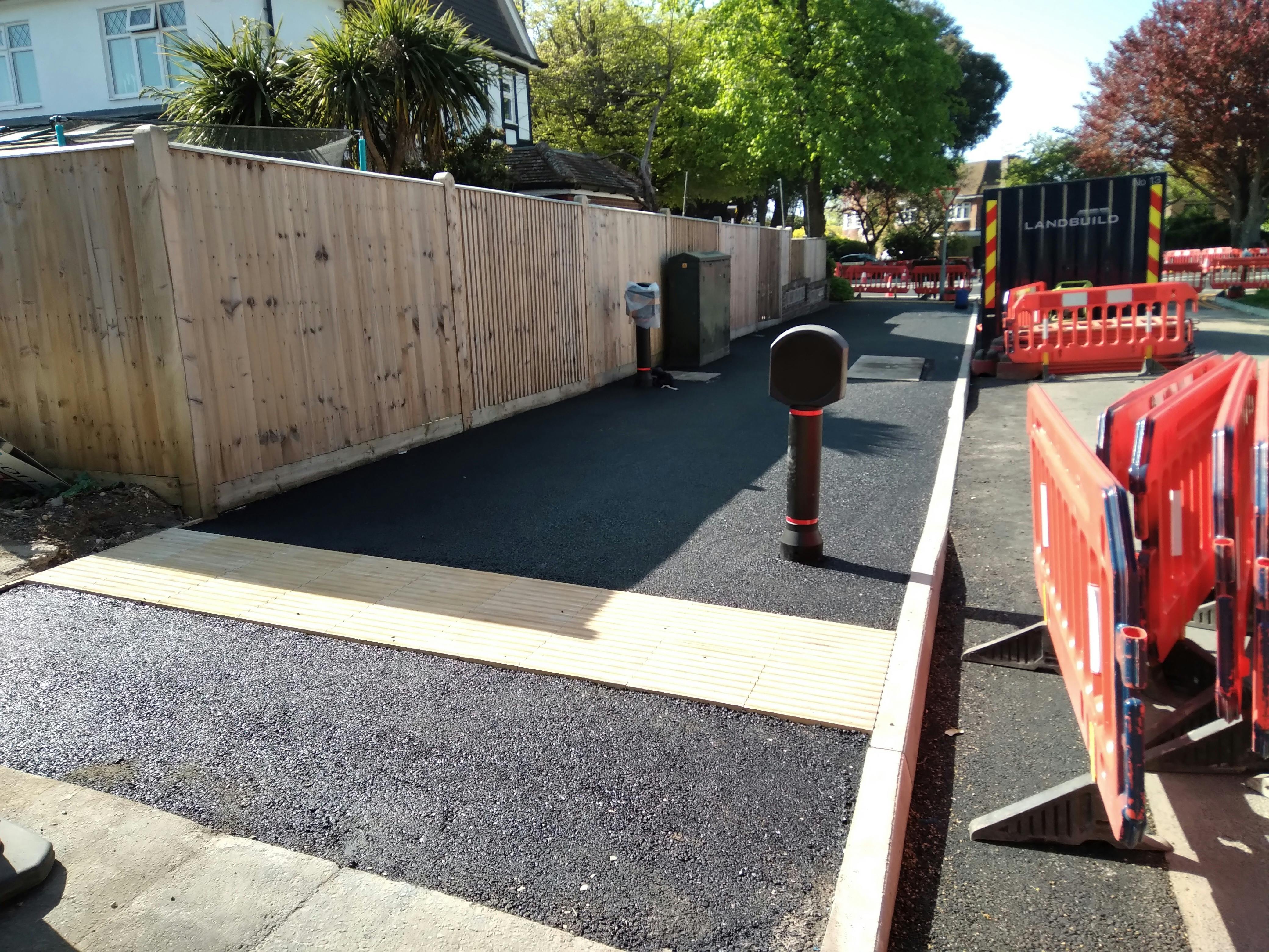
- Installation of cycle ‘bypasses’ at the two buildouts on Middle Road.
Please see individual designs for further details, however each inset tile shows:
- Overview plan showing all of the insets 1 to 9.
- Inset 1 – This drawing shows a proposed parallel crossing running north-south on Upper Shoreham Road, located between the two junctions with Buckingham Road. The crossing features a 3m wide cycle crossing with a 2.4m wide pedestrians crossing running parallel. It is connected by shared cycle/pedestrians paths on both side of Upper Shoreham Road, extending into The Drive to the north and Buckingham Road to the south. The Drive features a raised table road hump across the junction, with signage, tactile paving and road markings to prioritise pedestrian movements over vehicles. New double yellow lines are proposed running along the kerb line of The Drive/Upper Shoreham Road junction to protect visibility splays and obstruction of transition points for cyclists to enter/exit the shared path.
- Inset 2 – This drawing extends into the northbound spur of Buckingham Road and displays a proposed stepped cycle track for northbound cyclists, surfaced in a green surfacing.. There is also a raised table road hump across the junction, with signage, tactile paving and road markings to prioritise pedestrian/cycle movements over vehicles. The eastern kerb line of the road has been extended, narrowing the carriageway to a single lane.
- Inset 3 – This drawing shows the continuation of the shared cycle/pedestrian path on the south side of Upper Shoreham Road, extending into the southbound spur of Buckingham Road. There is a proposed raised table road hump across the junction, with signage, tactile paving and road markings to prioritise pedestrian/cycle movements over vehicles. The eastern footway in Buckingham Road is proposed to be widened to 3m for the majority, and become shared with cyclists, running south to Hamfield Avenue and connecting to Buckingham Park Primary School. New double yellow lines are proposed on the eastern corner of the junction of Upper Shoreham Road and the southbound spur of Buckingham Road to protect from parking and obstruction of the proposed crossing.
- Inset 4 – This drawing shows the fork in Buckingham Road where the northbound and southbound spurs connect at the base of The Triangle. It shows the continuation of the proposed 3m wide shared cycle/pedestrian path on the east side of Buckingham Road. It also shows proposed double yellow lines on the west side of Buckingham Road, replacing the existing single yellow line, protecting parking on the inside of the lefthand bend and allowing northbound cyclists for transition onto the proposed stepped cycle track without obstruction.
- Inset 5 – This drawing shows the continuation of the proposed 3m wide shared cycle/pedestrian path on the east side of Buckingham Road. It also shows proposed cycle symbol road markings on the northbound carriageway of Buckingham Road, leading cyclists to the stepped cycle track and warning users to the presence of cyclists.
- Inset 6 – This drawing shows the continuation of the proposed 3m wide shared cycle/pedestrian path on the east side of Buckingham Road, connecting into the existing shared path in Hamfield Avenue. There is also a proposed uncontrolled crossing north-south on Hamfield Road with a raised table road hump across the junction, with signage, tactile paving and road markings to prioritise pedestrian movements over vehicles. There is a proposed uncontrolled pedestrian crossing east-west on Buckingham Road, just north of the Hamfield Avenue access. The kerb lines on Windlesham Road have been extended, narrowing the carriageway at the junction and adding a proposed uncontrolled pedestrian crossing and bollards to protect from parking and obstruction.
- Inset 7 – This drawing shows the location of the existing priority traffic calming buildout outside of 65 Middle Road; proposed to be changed to include a 1.5m wide cycle bypass to allow cyclists to continue without having to give way when heading westbound. The bypass runs between the existing footway on the south side of the road and a proposed pedestrian refuge island, acting as a physical feature to continue to enforce priority for vehicles heading eastbound over those heading westbound. The refuge island features internally illuminated bollards and the cycle bypass is surfaced in a green surfacing. The existing tactile paving will be replaced.
- Inset 8 – This drawing shows the location of the existing priority traffic calming buildout outside of 111 Middle Road; proposed to be changed to include a 1.5m wide cycle bypass to allow cyclists to continue without having to give way when heading westbound. The bypass runs between the existing footway on the south side of the road and a proposed pedestrian refuge island, acting as a physical feature to continue to enforce priority for vehicles heading eastbound over those heading westbound. The refuge island features internally illuminated bollards and the cycle bypass is surfaced in a green surfacing. The existing tactile paving will be replaced.
- Inset 9 – This drawing shows the proposed new location for the speed camera currently situated on Upper Shoreham Road between the two junctions with Buckingham Road. The new location is still on Upper Shoreham Road, on the grassed centre reservation, but now between the junctions of Fairlawns and Buckingham Close. The camera will be a ‘spinner’, meaning that is can be turned to focus on either eastbound or westbound traffic. Road markings, in the form or intermittent lines, and proposed to support the camera in capturing vehicle speeds. The camera features a 5m x 3m hardstand adjacent to allow access for maintenance.
Hard copies of the plans will be available to view at Shoreham Library for the duration of the consultation.
Update 6th June 2024: We have extended the online survey close date from Friday 21st June to Sunday 30th June and will be improving notices within the improvement areas regarding the consultation following feedback from the local community.
Scheme Timeline
The scheduling of the works is subject to consultation. However, we are currently proposing to deliver the scheme by the end of this financial year, 2024-5. The duration of the works is estimated to be between 6 and 8 weeks.
Funding and Next Steps
The improvements are estimated to cost around £385,000. The scheme is being funded by Active Travel England which is an executive agency set up by central government with responsibility for improving walking, wheeling and cycling routes in the UK.
We will carefully consider comments received during the consultation and all Feedback received will inform the detailed design for the scheme. We will document this process and publish the results in a consultation report.
Alternate Formats and Accessibility
If you require any of this information in an alternative format, then please contact us by phone 01243 642105 or via email at activetravel@westsussex.gov.uk and we will assist you.
If you are deaf or hard of hearing and have a BT Relay UK app (opens in new window) installed on your computer, tablet, laptop or smartphone, you can contact us on [i18001 01243 642105]. The BT Relay UK app has now replaced the NGT texting app.
For more information about the accessibility of this website, please see our Accessibility tab (opens in new window) at the foot of the page.
Please note, you can use the Google Translate function to access this project in a range of different languages. The Google Translate widget can be found at the top left-hand side of the project page, where it sits just above the black West Sussex County Council ribbon.
Survey Web Browser Compatibility
Please use one of the browsers below when completing the survey to ensure it looks and works as it should. These are:
· Microsoft Edge version 86 and above
· Chrome version 86 and above
· Firefox version 78 and above
· Safari version 14 and above
Data Privacy Statement
The Active Travel Team will use these surveys to collect some personal data (e.g. age, sex), the processing of which is necessary for compliance with a statutory duty.
We will process this data in accordance with the 2018 Data Protection Act, General Data Protection Regulations and any subsequent relevant legislation. West Sussex County Council is registered as a Data Controller (Reg. No. Z6413427). The data you provide will not be used for any purpose other than that stated, and will be stored electronically for a period of up to 3 years before being safely and appropriately destroyed. For further information about our Data Controller, please see our Data Privacy Policy (opens in new window)


-
 Upper Shoreham Active Travel Initiative Overview Plan.V2 pdf.pdf (5.41 MB) (pdf)
-
Inset 1 Upper Shoreham Road Section V2.pdf (732 KB) (pdf)
-
Inset 2 Upper Shoreham Road to Buckingham Road Northbound Section. V2 pdf.pdf (695 KB) (pdf)
-
Inset 3 Upper Shoreham Road to Buckingham Road Southbound Section.pdf (607 KB) (pdf)
-
Inset 4 Buckingham Road Split Section.pdf (587 KB) (pdf)
-
Inset 5 Buckingham Road Section.pdf (566 KB) (pdf)
-
Inset 6 Buckingham Park School Gate Area.pdf (476 KB) (pdf)
-
Inset 7 Middle Road.pdf (565 KB) (pdf)
-
Inset 8 Middle Road.pdf (567 KB) (pdf)
-
Inset 9 Upper Shoreham Road Speed Camera Location.pdf (775 KB) (pdf)