
FAQs
Why is this work required?
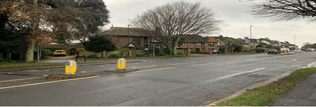
We are working to make walking, wheeling and cycling routes more attractive across West Sussex. The area where the signalised crossing point is proposed, on Upper Shoreham Road, has been identified as a site where pedestrians and cyclists frequently seek to cross the road. The work we are proposing to carry out will make this a safer and more convenient crossing point, whilst improving the route to Buckingham Park Primary School. Middle Road has also been identified as a site which is heavily trafficked by cyclists. The installation of cycle bypasses through the buildouts will improve safety and connectivity for network users. Upper Shoreham Road and Middle Road have been identified as benefiting from improvements as part of Worthing and Adur LCWIP. There has also been previous consultation and engagement around the scheme areas that has highlighted these proposals.
Where can I see the plans?
The proposed designs are available to view on this engagement page.
Hard copies of the plans will be available to view at Shoreham Library for the duration of the consultation.
When will this work take place and how long will it take?
The scheduling of the proposed works is subject to stakeholder consultation. However, we are currently proposing to deliver the scheme by the end of this financial year, 2024-5. The duration of the proposed works is estimated to be between 6 and 8 weeks.
Will the installation of the new zebra crossing affect the speed camera located at the junction of Upper Shoreham Road and Buckingham Road?
The proposed location for the parallel crossing would require the speed camera to be relocated. West Sussex County Council are currently liaising with Sussex Safer Roads Partnership (who are responsible for installing and maintaining all speed cameras across the county) about this issue. Under the current proposed design for the scheme, the speed camera will be moved to a new location on Upper Shoreham Road, as close as possible to its current location. However, this is subject to formal agreement with Sussex Safer Roads Partnership.
Why is this money not being spent on carriageway maintenance?
As an Active Travel scheme, this proposed work would be funded by central government capital funding and therefore it would have no impact on current carriageway maintenance budgets in West Sussex. Funding from Active Travel England is specifically allocated to schemes that improve walking, wheeling and cycling routes in the England, and West Sussex County Council is not permitted to spend this money on maintenance measures such as pothole repairs. However, carriageway conditions around the sites on Upper Shoreham Road and Middle Road will be assessed at the time of any works taking place, with any defects referred on to West Sussex County Council’s highway maintenance teams for repair.
How much will the scheme cost and who is paying for it?
The improvements are estimated to cost around £385,000. The scheme is being funded by Active Travel England, which is an executive agency set up by central government with responsibility for improving walking, wheeling and cycling routes in the UK.
There is a £385k underspend from the Findon A24 Active Travel Route Improvement that Active Travel England has agreed can be used to deliver schemes like this.
Will access to nearby properties be affected while the work takes place?
Access to properties will be maintained throughout the duration of the proposed works.
Will there be any tree loss?
We are proposing tree protection methods for those existing mature trees. However some smaller trees may need to be relocated as part of the proposed design.
What will the benefits be if the scheme goes ahead?
Newly surfaced footpaths, improved formalised parallel crossing point (the first in the county) improves route into Buckingham Road for pedestrians and cyclists, onward to schools, Shoreham railway station and other local facilities. A short section of segregated cycle track will also be provided on the northbound arm of Buckingham Road.
Why is this crossing being proposed so close to the existing zebra crossing?
The Drive/Buckingham Rd is considered a key north/south route for walking and cycling and there is a strong desire line at this point for a formalised crossing. It also forms a part of the school run and the aim is to encourage parents/carers to undertake part or all of their school run journey using more active modes. The existing Zebra crossing will remain to support crossing the road near Buckingham Park.
How will this project impact on climate?
The proposed project has been developed to support WSCC's climate pledge to reduce carbon emissions, by making active travel modes more attractive and thereby shifting journeys from modes of transport with higher carbon emissions.
Will the proposed works impact flooding of the area?
As far as we are aware, there are currently no flooding issues within the area. The proposed works do include raised table road humps at crossing points, which will require additional gullies to sufficiently drain the highway and ensure that the improvements do not create a flooding issue.
Is there scope to reduce the amount of shared use provision on the southbound arm of the Buckingham Road/Upper Shoreham Road junction, providing segregation instead?
While there is space to enable segregation on the southbound side of the Buckingham Road triangle, and this was considered during the early stages of the design, the current proposals enable people on bikes (many of whom will be young children) to travel north from the school without having to cross Buckingham Road, and without having to cycle on the carriageway. Were we to provide a segregated facility on the southbound side we would need to provide a similar facility on the northbound side all the way to the point parallel to the entrance to the school, and there is insufficient carriageway width to enable this on both sides of the carriageway. We would also need to provide a crossing point to enable northbound cyclists to connect to the cycle track from the school. Creating space for segregated cycle lanes whilst maintaining 1.5m (ideally 2.0m) wide footways would require realigning the kerbs and removal of two or three trees. It is also likely that we would need to prohibit parking throughout the extent of the scheme. The cost of this additional work would exceed the available budget and could generate objections. On balance we consider that shared provision on the southbound side of Buckingham Road is the most appropriate solution.
What are the next steps?
We will carefully consider all comments received during the consultation. Feedback received will inform the detailed design for the scheme. We will document this process and publish the results in a consultation report.