
Shoreham-by-Sea
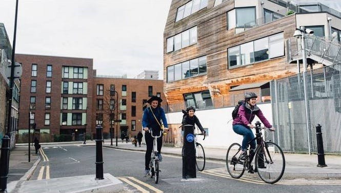
As part of the Government’s Active Travel Fund (ATF) initiative the County Council is seeking to develop measures to encourage walking and cycling. During Spring/Summer 2021 the Council consulted on options for a permanent cycling facility in Upper Shoreham Road between the Old Shoreham Tollbridge and Holmbush Roundabout, and potential measures to reduce the impact of traffic in Middle Road and Eastern Avenue, Shoreham-by-Sea.
Background
In Summer 2020 West Sussex County Council responded to a challenge from Central Government to provide measures to cater for a predicted upsurge in walking and cycling following the end of the Covid 19 Lockdown. Temporary facilities were installed in various locations throughout the County. Of the measures installed the Upper Shoreham Road cycle route was deemed to be successful in terms of usage and as a result the Council engaged with the public in Spring 2021 to gauge support for a permanent improvement on this corridor as well as supporting improvements on the surrounding road network. The results of the engagement process are summarised in table 1 below:
Table 1 – Headline support for potential improvements - March 21 Engagement.
Following the initial engagement process the Council worked up two scheme options for Upper Shoreham Road and developed ideas for reducing the impact of traffic on Middle Road and Eastern Avenue. The designs and concepts were consulted on in July 2021.
There were more than 1,600 responses to the consultation. You can read more of the consultation report (opens in new window). Neither of the two options for a segregated cycle facility on the Upper Shoreham Road were well supported, although there was a higher level of support for improving cycling and walking facilities in Shoreham, particularly relating to school travel.
Measure | Support | Oppose |
A permanent high quality cycling facility on Upper Shoreham Road | 65% | 29% |
Measures to reduce the impact of traffic on Middle Road | 71% | 16% |
Measures to reduce the impact of traffic on Eastern Avenue | 67% | 19% |
A crossing facility to link USR to the Old Shoreham Toll Bridge | 74% | 10% |
The results of the consultation are summarised in tables 2 and 3 below:
Table 2 – Support for Upper Shoreham Road Cycleway options - July 21 Consultation.
Measure | Support | Oppose |
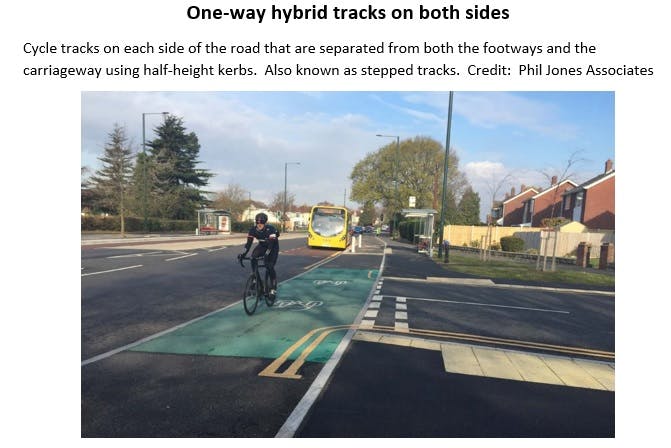
A one-way cycle track on both sides of USR (View Drawing) | 45% | 51% |
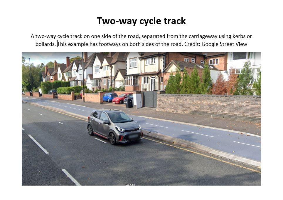
A two-way cycle track on the south side of USR (View Drawing) | 25% | 65% |
Table 3 - Support for potential improvements to reduce impact of traffic in Middle Road and Eastern Avenue (View Map) - July 21 Consultation.
Measure | Support | Oppose |
Installation of pedestrian priority crossings at side road junctions | 63% | 18% |
Installation of school street zones (restricting motor vehicle access to school streets during drop off and pick up times) | 52% | 29% |
Upgrade cycle priority measures at Eastern Avenue / Middle Road traffic signals | 50% | 34% |
Introduction of increased parking restrictions for safer cycle movements | 45% | 40% |
Introduction of modal filters (Bollards, kerbs, and planters etc) to prevent motor vehicle through-traffic, whilst allowing walkers and cyclists to pass. | 44% | 40% |
Conversion of Park Avenue into a one-way street with contraflow cycle facilities to reduce motor vehicle through-traffic. | 39% | 37% |
Installation of a bus gate on Wilmot Road, near Stoney Lane, to reduce motor vehicle through-traffic. | 35% | 42% |
Next Steps
The County Council remains committed to providing cycling and walking improvements and so intends to engage further with stakeholders over the coming months to see whether there is a solution for the Upper Shoreham Road and surrounding area that would deliver meaningful improvements whilst allaying any concerns residents may have. This will allow us to understand what detailed proposals might be achievable.
The consultation demonstrated a level of support for some of the measures to encourage walking and cycling, with a focus on school travel. The Council is working with local schools to help draw up more detailed proposals for further engagement in 2022.
Steyning Road Crossing Point
In addition to the schemes mentioned above the Council consulted on plans for a signal-controlled ‘toucan’ crossing point on Steyning Road between the Tollbridge and Upper Shoreham Road. – the consultation process, which took place in July/August 2021. Of those people who expressed either support or opposition, 94% were in favour of the pedestrian and cycle crossing. The scheme is scheduled for construction in (2022/23).

Photos
Documents
-
 Pre-Consultation Engagement
-
ATF Shoreham Engagement Summary Report
-
Full Public Consultation Plans
-
 Eastern Avenue/Middle Road Measures (228 KB) (pdf)
-
Upper Shoreham Road Consultation Plans_Option 1A_v7 - One Way Both Sides (1.52 MB) (pdf)
-
Upper Shoreham Road Consultation Plans_Option 1B_v5 - Two Way South Side (1.28 MB) (pdf)
-
WS32945 A3 Poster Shoreham BN43 Stage 2 (166 KB) (pdf)
-
WS32945 A6 Postcard Shoreham BN43 Stage 2 (655 KB) (pdf)
-
-
ATF Shoreham Consultation Summary Report
-
Consultation Report (5.75 MB) (pdf)

