
A259 Hove to Portslade active travel scheme consultation
Overview
Brighton and Hove City Council have ambitious plans to improve travel and transport for people in Brighton & Hove (and where it crosses over surrounding boundaries). They want to make it easier for residents and visitors to move into and around the city. They also want to provide better, safer and accessible travel options that work for everyone.
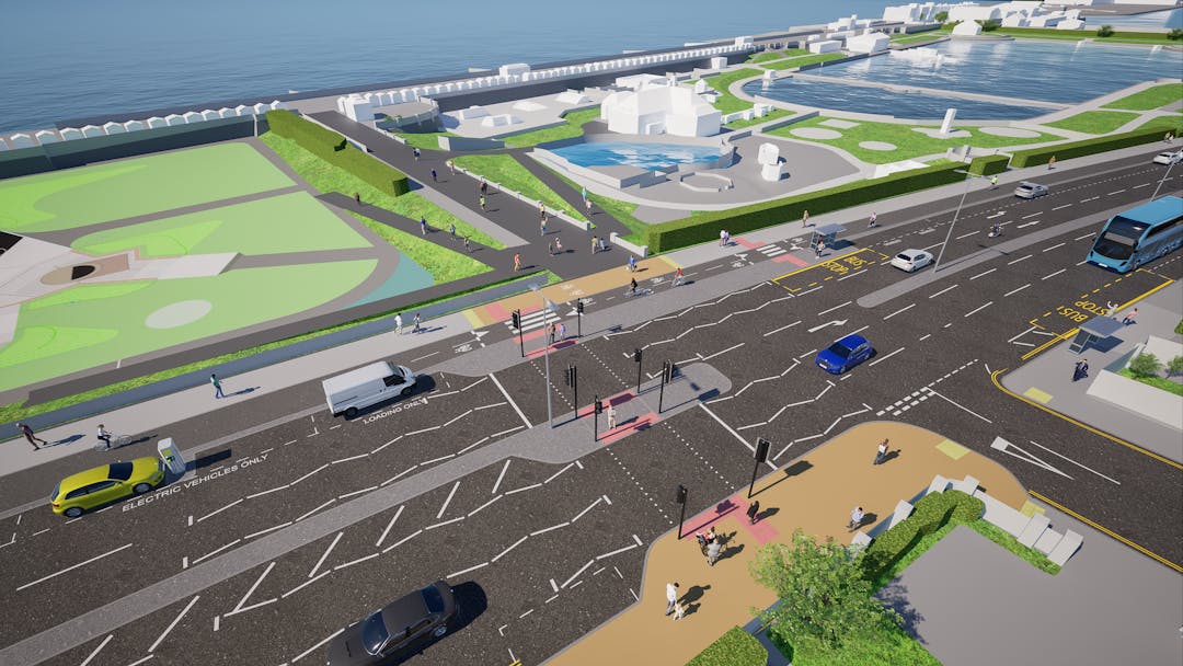
As part of this, Brighton and Hove City Council are currently developing plans to improve the A259 between Fourth Avenue, Hove and just beyond the city’s western boundary at Mill Road, Fishersgate.
The scheme would improve walking and cycling infrastructure in a key part of the seafront, linking people with the new Hove Beach Park facilities, the promenade, shops, attractions, a new King Alfred Leisure Centre and then towards Southwick, Shoreham, Lancing and Worthing.
It would complete a route which means people could cycle from Brighton Marina all the way to the western boundary of the city, but would also see improvements to road crossings, pavements, junctions and road surfaces.
The plans (funded by Active Travel England and the council's Local Transport Plan funding) include two phases and:
• A separated two-way cycle lane
• New pavements and bus stops
• Safer, better aligned crossings and junctions
• New loading and disabled parking bays
Phase one: From Fourth Avenue to Wharf Road
Phase two: From Wharf Road to the city’s western boundary
Your feedback is needed
Brighton and Hove City Council would like to invite you to have your say on one or both phases of the proposed improvement scheme for this key route. Your feedback and comments will help inform and shape the final project design. Please read the attached leaflet and visit their project webpage (opens in new window) to participate and share your views by Sunday 27 July 2025.
Accessibility and alternate formats
To request a paper copy or another format please email Transport.Projects@brighton-hove.gov.uk or call 01273 294 808 and leave a message with your request. Brighton and Hove City Council will also be holding several public engagement events where you can see the plans and you will be able to ask questions about the scheme. Details will be published and available to view on their project webpage (opens in new window) from Monday 16 June 2025.
After Monday 16 June, you can also access the project page by scanning the QR Code below:
 Project QR Code